Picture this: your boat on a sunny morning, lines off, and a quick run from your Key Haven dock to clear water. That is the dream for many buyers, but canal depth, tides, and bridge clearances decide whether it is easy or a hassle. If you plan to keep a vessel at a Key Haven home, you need the facts before you write an offer. In this guide, you will learn typical canal depths, how draft interacts with tides, where bridges come into play, common routes to the Gulf and Atlantic, and a smart verification checklist you can use during contingencies. Let’s dive in.
Key Haven canal depths
Most Key Haven canals are man-made and vary from shallow to moderately deep. You will see three broad depth patterns at mean lower low water (MLLW), which is the standard marine datum for charts and planning.
- Shallow residential canals: about 2–4 feet at MLLW. These suit skiffs, flats boats, and shallow-draft center consoles. Timing exits with tide often helps.
- Moderately deep canals: about 4–6 feet at MLLW. Many center consoles, bay boats, and small cruisers fit here.
- Channel-front or basin lots: 6 feet or more at MLLW. These are less common and can handle larger cruisers or small trawlers, often at premium prices.
Depths can shift over time due to shoaling and storms. Treat any posted number as a starting point and verify during inspections.
Tide and chart basics
Key West’s tidal range is relatively small. Local NOAA tide data shows an average swing of about 1–2 feet between mean higher high water and mean lower low water. That small range still matters if you plan to move through a shallow canal at low tide.
Charts list depths relative to MLLW. If a canal reads 4 feet on the chart and your boat drafts 2.5 feet, you have a margin at low tide that can shrink further with seasonal effects. Always plan using MLLW so you understand your worst-case depth.
Boat draft and real-world depth
Draft is only half the equation. You also need to think about prop type, load, and safety margin.
- Keep a cushion. A simple rule is to retain at least 6–12 inches below your keel or props at low tide, more for inboards.
- Weigh the boat as used. Fuel, water, gear, and crew can add inches of draft.
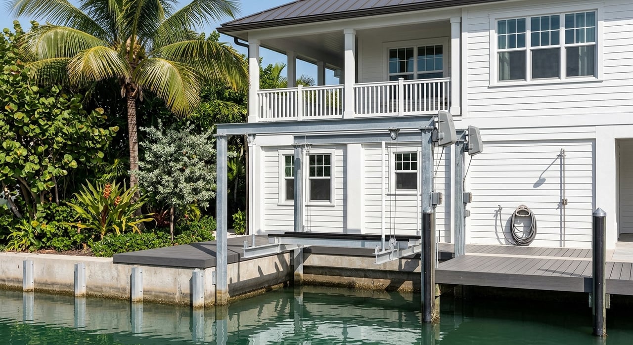
- Consider lifts. If your ideal home has a shallower canal, a properly permitted lift can solve storage and fouling concerns while you time departures with the tide.
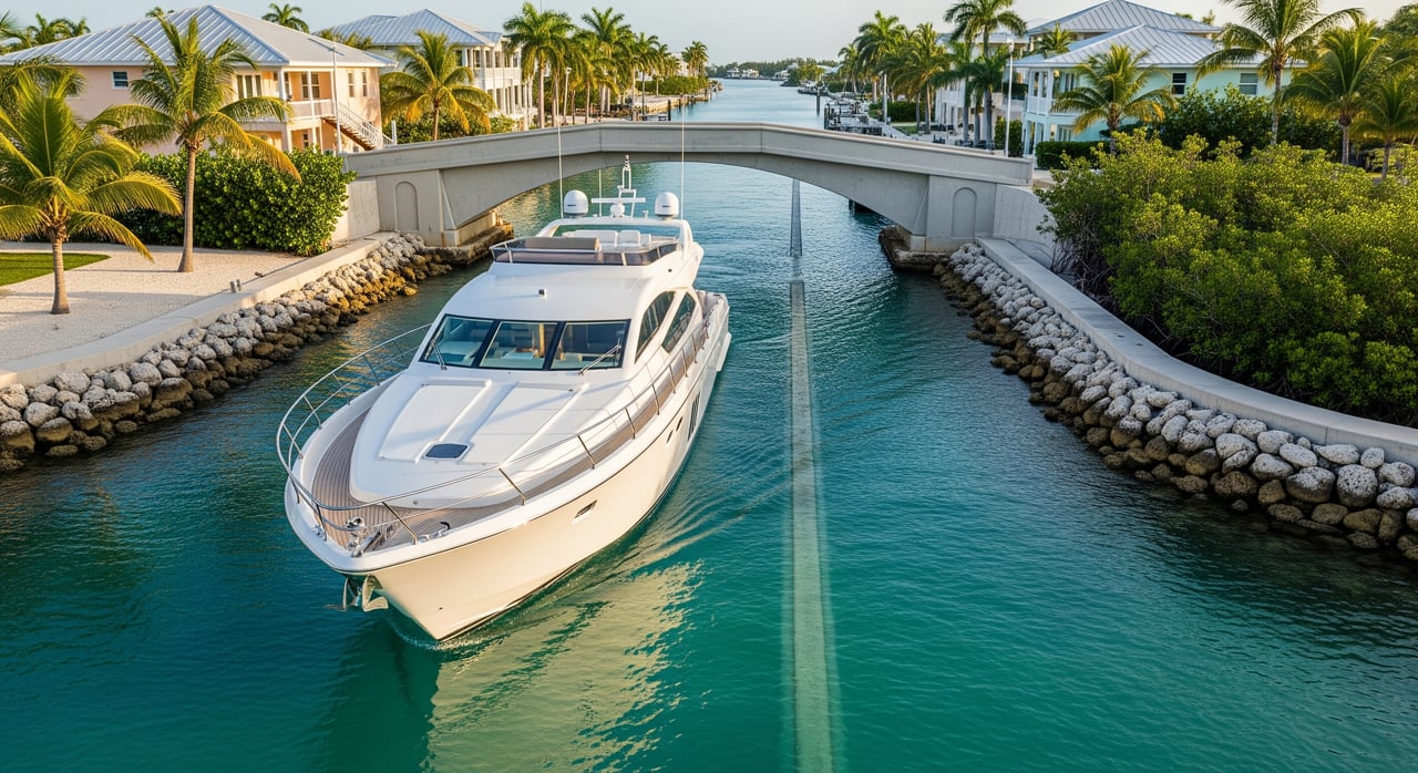
Bridge clearances to consider
Vertical clearance affects boats with towers, hardtops, and especially masts. Many Keys road causeways are fixed bridges with published clearances. Inside the Key West harbor area and around Key Haven, most small powerboats can pass, but tall-mast sailboats may be limited by the route you choose.
- Verify before you rely. Consult official bridge data and chart annotations for exact clearances on your intended path from canal to open water.
- Know your air draft. Measure from the waterline to the highest fixed point on your boat and compare against bridge clearances at mean high water.
- Watch for updates. Temporary restrictions can appear after storms or maintenance. Check current notices during your inspection period.
Routes to Gulf and Atlantic
From Key Haven, you can reach both sides of the Keys with short runs if you follow marked channels and local guidance.
- Atlantic-side route. Use local channels that lead toward Hawk Channel, the deeper corridor along the Atlantic reef line. Many boaters run east or north from Key West harbor basins to access it.
- Gulf-side route. Boca Chica Channel and other marked passages around the east side of Key West and Stock Island provide access toward the Gulf side.
- Harbor connections. Key West Harbor, Cow Key Channel, and the Garrison Bight basin are common waypoints in local transits. Confirm buoyed fairways and charted depths before your first run.
Because channels can be narrow and shoals shift, local knowledge from marina operators and captains is valuable, especially for your first trips.
Match your boat to property
Choosing the right canal is as important as choosing the right house. Use this quick fit guide.
- Kayaks, paddleboards, skiffs under 1.5-foot draft: Fit almost any canal and have no bridge concerns.
- Center consoles and bay boats with 1–2.5-foot draft: Work well in 2–4-foot MLLW canals, especially with tide planning.
- Small cruisers and dual-outboard boats with 2–4-foot draft: Prefer 4–6-foot MLLW canals or basin-front lots. A lift may help in shallower canals.
- Trawlers and larger yachts with 4-foot-plus draft: Typically need deep channel-front homes or marina slips.
- Sailboats with tall masts: Verify every bridge on your route or target lots with bridge-free access via larger basins.
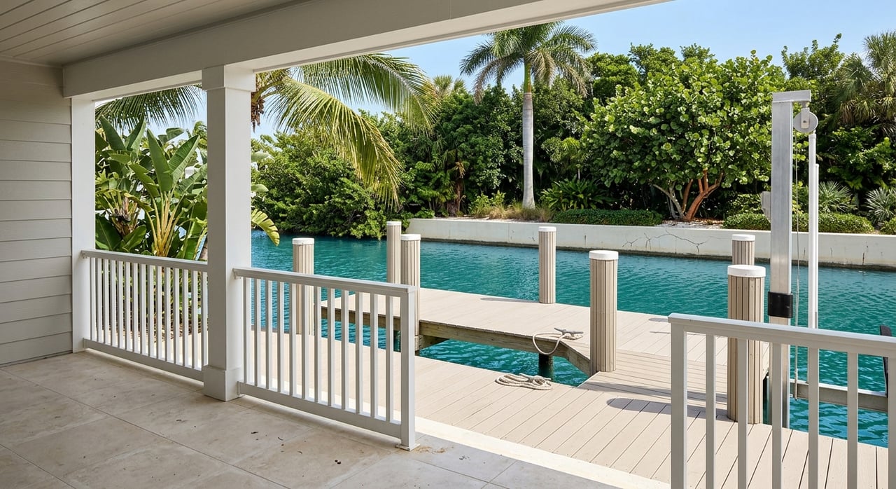
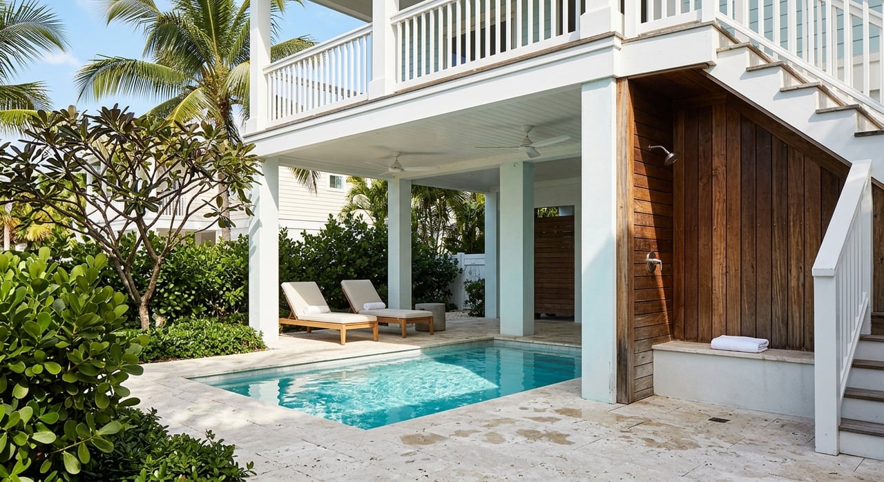
When touring homes, note whether a lot sits on an interior narrow canal or near a wider channel. Check the seawall condition, any installed lift, and how close you are to marked routes.
Due diligence checklist
Use your inspection window to confirm boating access. This gives you confidence and leverage.
- Review current charts covering Key Haven and nearby approach channels. Confirm charted depths and marked fairways.
- Request seller records. Ask for recent sonar or depth readings and any dredging permits that show permitted depth.
- Order a third-party sonar survey. A hydrographic reading during normal low water is ideal for boat owners.
- Compare draft to MLLW. Calculate your lowest water clearance using the local tide range and your boat’s typical load.
- Verify bridge clearances on your specific route. Use official sources to check vertical clearance and any temporary restrictions.
- Confirm lift and dock rights. Check county and state permitting rules for lifts, hoists, and seawall work. Review HOA rules if applicable.
- Talk to local marinas and neighbors. Ask about seasonal shoaling and practical exit tips for your canal.
- Plan alternatives for larger vessels. Explore slip availability at nearby marinas if your boat exceeds the canal’s comfort zone.
- Measure air draft and inspect overheads. Walk and boat the route to spot any lines or structures that may not appear on a quick drive-by.
Permits and upkeep basics
Canal dredging and maintenance are tightly regulated in Monroe County and the Florida Keys. Individual owners usually cannot deepen a canal without permits from county and state agencies. Seawall and lift projects also require permits and must meet local standards.
Storms and seasonal winds can shift bottoms, so even historically deep canals may change. After major events, check updates and notices before you plan any runs with minimal under-keel clearance.
Local guidance you can trust
Buying on the water in Key Haven is about matching your lifestyle and your boat to the right canal and route. A careful review of depth, draft, tides, and bridge clearances will save you time and money and help you enjoy the Keys the way you imagine.
If you want a waterfront home that fits your vessel and your vision, connect with a local advisor who understands both real estate and boating access. For concierge guidance and a smooth, data-driven purchase, reach out to Sherri Blasingame.
FAQs
What are typical Key Haven canal depths?
- Most canals range from about 2–4 feet to 4–6 feet at mean lower low water, with 6 feet or more near channel-front or basin lots.
How much is the Key West tidal range?
- The local NOAA tide station shows an average range of about 1–2 feet, which still matters when planning shallow transits at low tide.
Which bridges affect Key Haven boat access?
- Many road causeways have fixed clearances. Verify the specific bridges on your route using official sources and compare to your boat’s air draft.
What routes lead to the Atlantic and Gulf?
- Boaters commonly transit via Key West Harbor, Cow Key Channel, and Garrison Bight, then choose Boca Chica Channel for Gulf access or head toward Hawk Channel on the Atlantic side.
Can I dredge my canal to increase depth?
- Dredging is closely regulated in Monroe County and typically requires permits from county and state agencies. Do not assume dredging is allowed.
How do I confirm a property will fit my boat?
- Order a sonar depth survey, verify bridge clearances, compare your draft to MLLW using local tide data, and review permits for any lift or dock work.