Dreaming of stepping from your back porch onto your boat, then cruising to open water in minutes? If you are eyeing Cudjoe Key for canal-front living, you are on the right track. The island’s canals range from deep, flow-through channels to quiet back-country cuts, which means you can match a home to your boat and lifestyle if you know what to look for. In this guide, you will learn how to choose the right canal, vet dock feasibility, understand permits, and inspect key systems so you can buy with confidence. Let’s dive in.
Why Cudjoe Key works for boaters
Cudjoe Key sits around Mile Markers 21 to 23 on US 1, roughly 20 to 25 miles from Key West. You get quick access to island amenities without living in the center of the action. Many buyers value the balance of boating convenience and quieter residential streets.
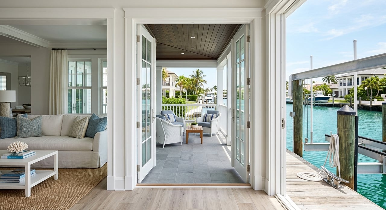
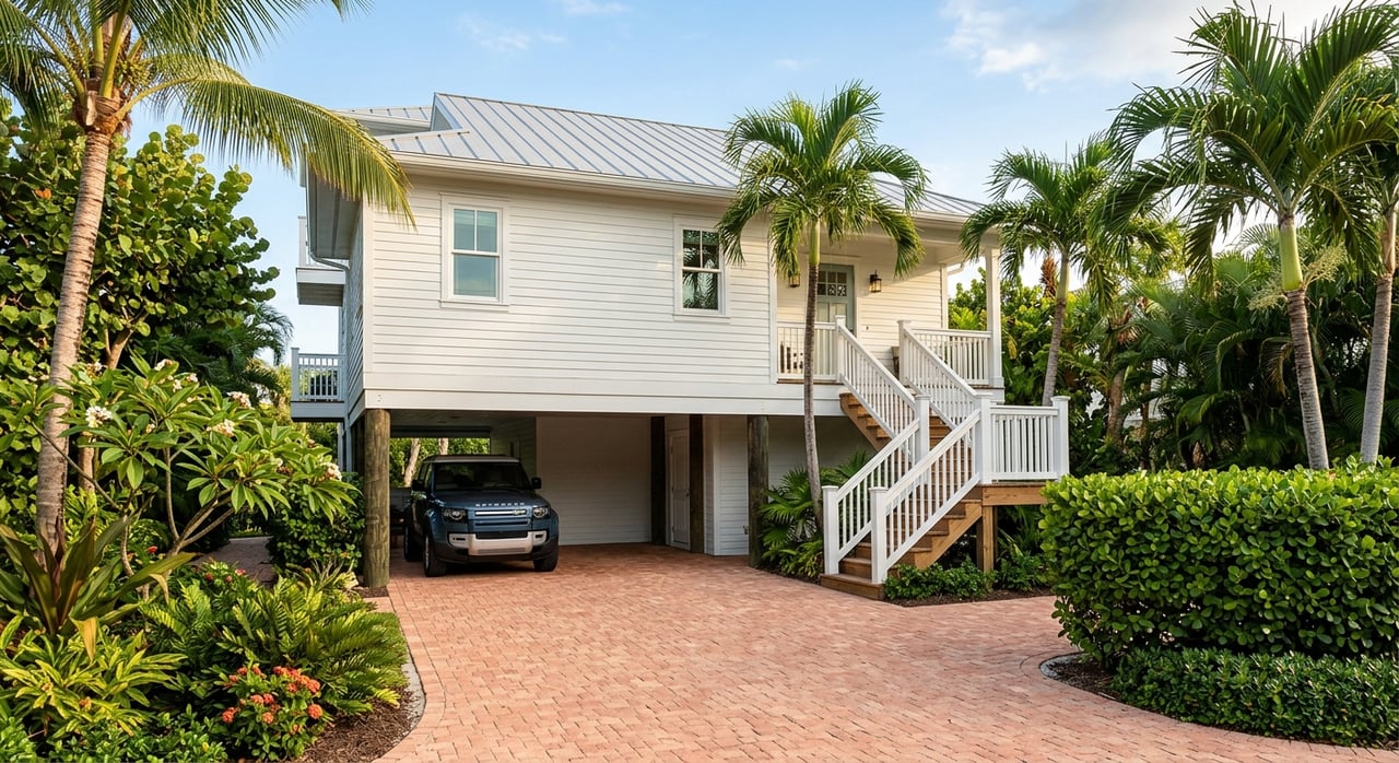
Canal conditions vary by neighborhood. Cudjoe Gardens is known for deeper, flow-through canals and quick access to open water, supported by nearby services at Cudjoe Gardens Marina. Other sections offer sheltered, shallower canals that suit flats boats and back-country fishing. Public ramps, such as Blimp Road, add extra flexibility for guests and secondary boats.
If you are comparing islands, Cudjoe Key often offers larger-boat access than many shallow canal networks in the Lower Keys, while keeping you closer to Key West than Middle Keys options. Your decision should start with your vessel type and the canal’s depth and route to open water.
Canal types and neighborhoods
Cudjoe Gardens deep-water advantages
If you run a larger center console or sportfish, Cudjoe Gardens is a practical fit. Deeper, flow-through canals reduce shoaling risk and speed your run to the ocean or back country. The presence of fuel, pump-out, and service nearby simplifies weekend routines for frequent boaters.
Interior and east-side canals
Interior canals and eastern inlets can be shallower or narrower. They are often well suited to bay boats, skiffs, and kayaks. Always verify actual depths, entrance conditions, and potential bridge or air-draft limits on your specific route.
Your boating access checklist
Use this quick checklist early in your search. A little homework avoids costly surprises later.
- Measure depth along the entire route. Compare your boat’s draft plus at least 1 foot of clearance to measured depths at mean low water. State siting policies often treat about negative 4 feet MLW as a key threshold for safe mooring of many vessels, with more depth needed for deeper drafts. See Florida’s dock siting criteria in FAC 18-21.0041.
- Confirm no-bridge or bridge-limited routes. Some neighborhoods have low fixed crossings that limit air draft. Many parcels in Cudjoe Gardens have quick, no-bridge access.
- Check for seagrass or hard bottom. Sensitive habitats trigger design limits like grated decking, narrower walkways, higher clearances, and potential relocation of a proposed dock. The U.S. Army Corps’ regional guidance explains common limits in the Keys under SAJ-82.
- Verify pump-out and services. Regular pump-out and fueling are essential for larger vessels. Nearby options include services at Cudjoe Gardens Marina.
- Align elevation data. Use the nearest NOAA tidal datum for mean lower low and mean high water to ground any bathymetry or dock design discussion with your surveyor. See the Cudjoe-area station on NOAA Tides & Currents.
Dock permits and design rules
Dock permitting in the Florida Keys involves multiple agencies and more scrutiny than many mainland locations. Plan for a layered process and build in time.
- Start with state and federal authorizations. Typical reviews stack in this general order: the Florida Department of Environmental Protection, the U.S. Army Corps of Engineers, and the Florida Keys National Marine Sanctuary, then Monroe County for the local building permit. The FDEP guide is a useful overview of what to expect in Florida’s coastal waters. Review the state’s process in the FDEP dock permitting guidance, the Corps’ Keys regional permit SAJ-82, and FKNMS requirements for sanctuary waters at FKNMS permits.
- Understand siting and depth thresholds. Florida’s marina and dock siting policies include depth, projection, and footprint limits designed to protect navigation and habitats. Many reviews rely on negative 4 feet MLW as a baseline for safe mooring and clearance, with deeper mooring required for boats with larger draft. Dock projection, platform area, and walkway widths are also capped. See the statewide Keys criteria in FAC 18-21.0041.
- Follow Monroe County’s local rules. Local code sets setbacks from side lines, limits on T-docks and walkways, and specific material standards for pilings and seawalls. You will apply for the county building permit only after state and federal authorizations are in hand. Review shoreline and dock standards in Monroe County LDC Chapter 118.
- Budget for surveys and time. Agencies expect a complete submittal package that often includes bathymetry, a benthic (seagrass) survey, and a site plan to avoid and minimize impacts. Incomplete packages can add months to your timeline, so hiring local specialists early helps keep your project on track.
Orientation, views, and coastal risk
Orientation shapes your daily experience and maintenance profile. Open-water or channel-facing lots offer wide views and direct runs but are more exposed to wind, chop, and boat traffic. Canal-oriented lots are often quieter and better protected, though you still need to confirm that the canal entrance is navigable at lower tides.
Always ground elevation and flood discussions in official tidal datums. NOAA’s local station provides mean high water and mean lower low water values used by surveyors and permitting agencies. Check your baseline on NOAA Tides & Currents.
For long-term resilience, review Monroe County’s sea level rise and inundation maps. Neighborhood-level data can show potential road overtopping, tide-flood frequency, and planned resilience projects that may affect access and value over time. See the county’s Vulnerability Assessment and Inundation Maps.
What to inspect before you bid
A canal-front home adds marine systems and floodplain factors to your usual inspection list. Bring qualified pros to the table early.
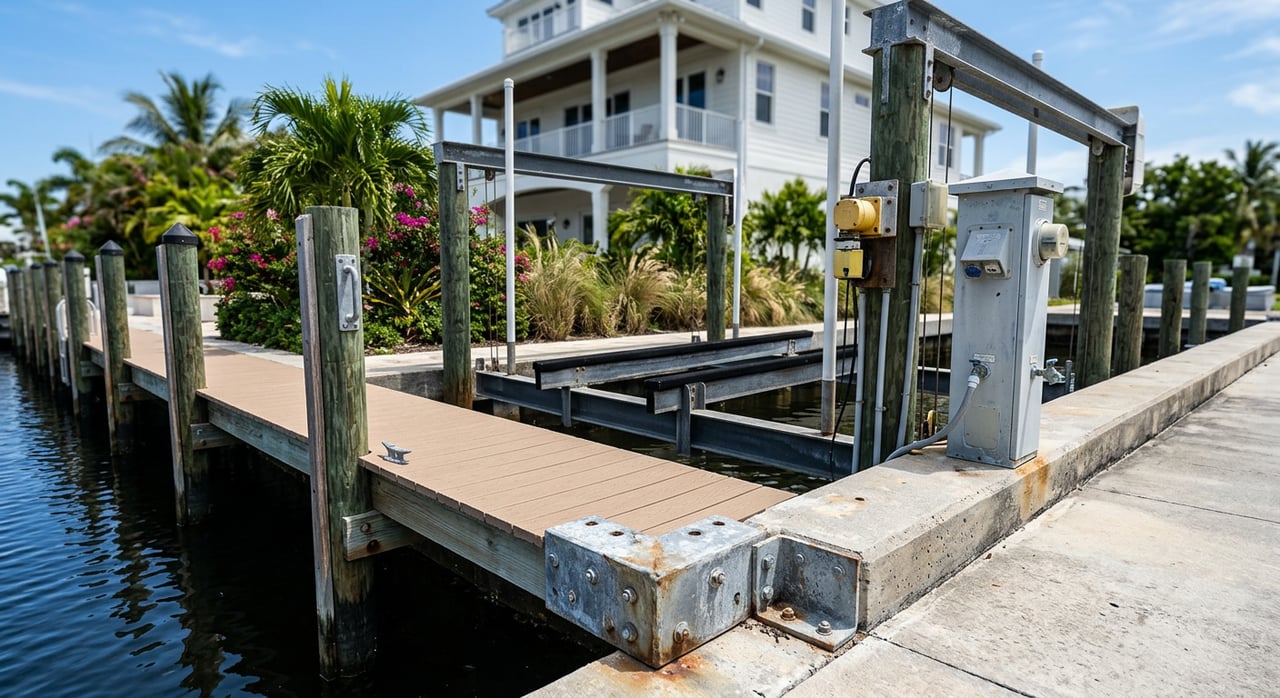
Waterfront and dock systems
- Elevations and certificates. Verify the as-built elevation of the lowest floor and structural members against the base flood elevation. If no Elevation Certificate exists, order a licensed survey. See floodplain requirements in Monroe County LDC Chapter 122.
- Seawall or revetment condition. Look for cracking, leaning, undermining, toe scouring, and cap deterioration. Replacements and repairs must follow county standards. Review shoreline rules in LDC Chapter 118.
- Dock structure and utilities. Inspect pilings for marine-borer damage and verify correct wrapping or approved materials. Check decking, hardware, and any dock power for proper GFCI protection and labeled breakers at compliant elevations.
- Bathymetry at the slip. Confirm measured depth at mean low water and look for prop scour that can signal shoaling or overuse by deeper boats.
- Boat lifts and davits. Verify existing permits, rated capacity, and placement relative to setbacks. Lifts are treated differently than floating systems under local code. See limits in LDC Chapter 118.
- Seagrass or hard bottom. If sensitive habitats exist under or near the dock, expect grated decking, narrower platforms, higher clearances, or relocation. The Corps’ SAJ-82 provides common Keys parameters.
House and site risk items
- Sewer connection. Confirm whether the parcel is tied into the Cudjoe Regional system. Connection status affects cost, compliance, and environmental impact. Start with the county’s summary at Monroe County Wastewater.
- Electrical, HVAC, and generators. Equipment must be located at or above required elevations under local floodplain rules. Review elevation compliance in LDC Chapter 122.
- Roof age, shutters, and impact openings. Note roof type and age, plus the presence of impact-rated windows and doors. These items affect insurance, storm resilience, and lending.
- Prior storm repairs. Review disclosures and permit history for substantial improvements, which can trigger full-code compliance under floodplain rules.
Title, permits, and sovereign lands
- Riparian and submerged lands. Confirm if the state owns the bottom beneath or beyond your dock and whether a lease or consent is required. The state’s process and sovereign lands issues are outlined in the FDEP dock permitting guidance.
- Permit history. Request permit numbers for the dock, seawall, lifts, and major structural work to confirm they were permitted and closed.
- Survey and legal description. Verify seaward boundaries, easements, and any cut-in basins. If a dock crosses state-owned bottom, a lease or easement may be required under Keys siting standards in FAC 18-21.0041.
Cudjoe Key vs nearby alternatives
- Canal depth and boat size. Cudjoe Gardens offers deeper canals that suit larger boats and faster runs, while some neighborhoods in the Lower Keys trend shallower for skiffs and bay boats. Always verify depth parcel by parcel.
- Distance to Key West. Cudjoe’s location trims drive times compared with many Middle Keys options, which is helpful if you want city access and a protected canal at home.
- Pricing varies by micro-location. On-water orientation, canal depth, and neighborhood rules drive value more than the island name alone. Treat medians as context and ask for up-to-date MLS data by canal and orientation.
- Infrastructure differences. Many Lower Keys neighborhoods connect to the Cudjoe Regional sewer system, which reduces the risks and costs tied to septic. Confirm service status via Monroe County Wastewater as part of due diligence.
A simple path to a smart purchase
Here is a streamlined approach you can follow with a knowledgeable local advocate:
- Define your boating profile. Note your boat’s draft, beam, and air draft, plus desired run time to open water.
- Shortlist by canal. Focus on canal depth, entrance conditions, and bridge-free routes. Use the local NOAA datum for accurate depth comparisons at NOAA Tides & Currents.
- Pre-screen permits and feasibility. For any planned dock changes, align early with FDEP, USACE, and FKNMS requirements. See the process overview at FDEP, the Corps’ SAJ-82, and FKNMS permits.
- Order the right inspections. Combine a general home inspection with a licensed survey, bathymetry, and benthic survey if needed. Confirm flood elevations under LDC Chapter 122 and dock rules under LDC Chapter 118.
- Align insurance and maintenance. Canal orientation, seawall type, and wind exposure will shape long-term costs. Review county Vulnerability Maps for a forward look.
If you are ready to zero in on the right canal and home, let’s put a plan together that matches your boat, budget, and lifestyle. For concierge-level guidance from search to close, connect with Sherri Blasingame for a private consultation.
FAQs
What makes Cudjoe Key attractive for canal-front boaters?
- You get deeper, flow-through canals in areas like Cudjoe Gardens, quick runs to open water, nearby marina services, and a shorter drive to Key West compared with many alternatives.
How deep are the canals and which fit larger boats?
- Depth varies by canal and parcel; many agencies treat about negative 4 feet MLW as a safe starting point for mooring, but larger drafts need more, so confirm measured depths along your whole route.
What permits do I need to build or modify a dock?
- Expect reviews by FDEP, the U.S. Army Corps, and the Florida Keys National Marine Sanctuary before applying to Monroe County for a building permit, with design limits tied to depth, projection, and habitat.
How long do Florida Keys dock permits take?
- Multi-agency reviews can take several months, especially if biological surveys or design changes are required; complete, professional submittals help prevent delays.
How should I evaluate flood risk and elevations?
- Use NOAA tidal datums for accurate elevation benchmarks, verify an Elevation Certificate, and confirm compliance with Monroe County floodplain rules tied to base flood elevation.
Is Cudjoe Key connected to central sewer and why does it matter?
- Many parcels are served by the Cudjoe Regional system; connection reduces septic risks and affects compliance, costs, and resale value, so verify service during due diligence.
How does Cudjoe Key compare with Sugarloaf or Summerland for boating?
- Cudjoe Gardens often provides larger-boat access and fast runs, while some nearby areas trend shallower or more exposed; match your boat’s draft and your preferred route to the specific canal.